You picture stepping from your back deck onto your boat, coffee in hand, and easing out to the sound at sunrise. In Wanchese, that vision is possible, but only if the dock, the water depth and your access line all work for your vessel and your lifestyle. Buying waterfront here means understanding working-waterfront realities, coastal permits and how draft and shoaling affect day-to-day boating. This guide gives you clear, local context plus a practical checklist so you can buy with confidence. Let’s dive in.
Why Wanchese waterfront is unique
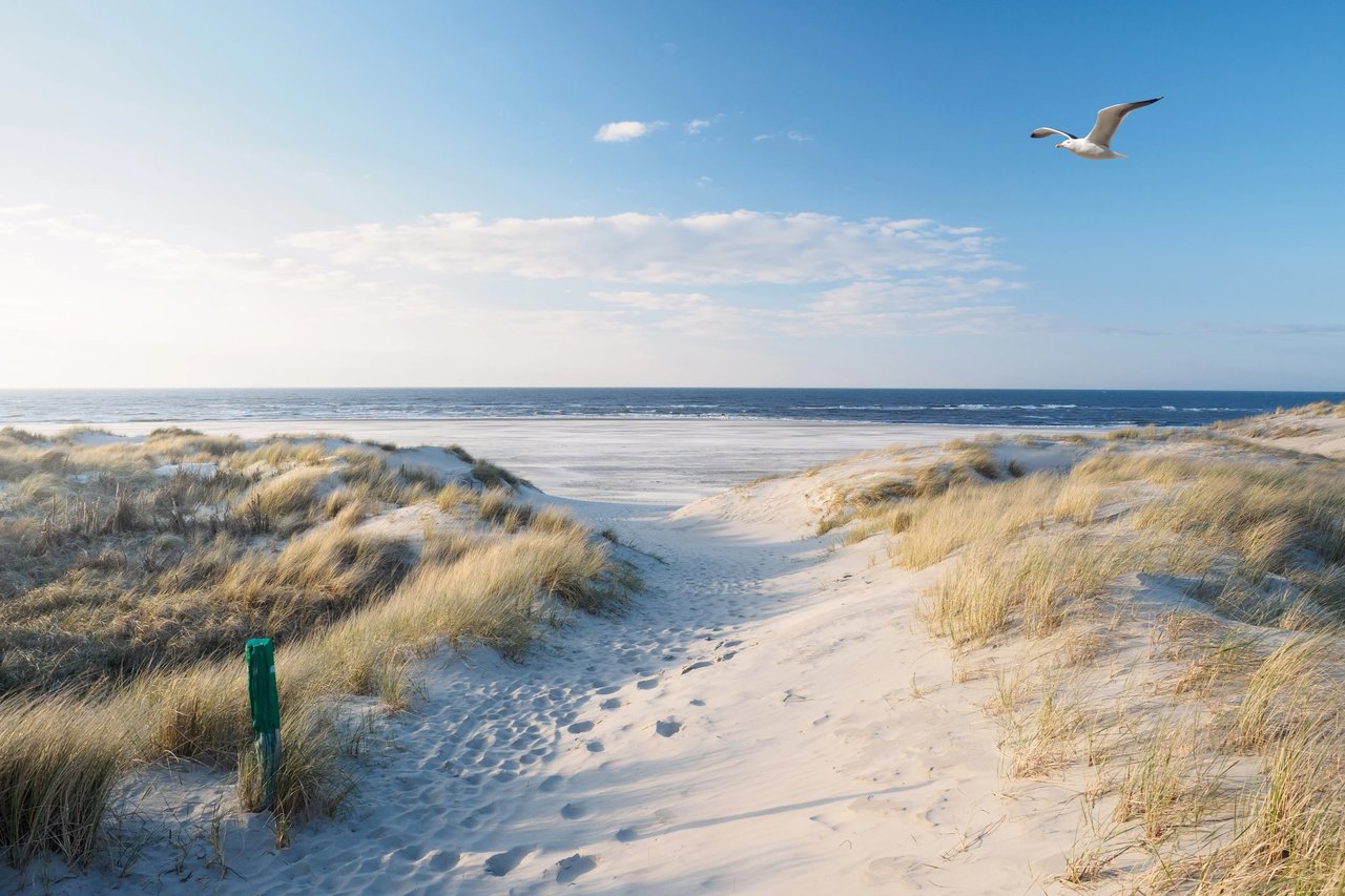
Wanchese sits on the south end of Roanoke Island on the sound side of the Outer Banks. Properties marketed as sound-front, canal-front or water-access are part of a large estuarine system connected to the Atlantic through Oregon Inlet. You get sheltered waters and beautiful views, but you also have changing depths influenced by wind, tides and seasonal conditions.
The village is a long-standing commercial fishing and seafood hub. You will see working docks, gear and vessel traffic that can affect navigation, wakes and what is permitted on or near the water. If you want to be close to the maritime heartbeat of the Outer Banks, this is part of the appeal.
Coastal processes matter for buyers. Tides on the sounds are modest but vary locally, and wind can push water levels up or down. Shoaling near inlets can alter nearby channels over time. Storm surge, waves and long-term sea-level rise create real risks for docks and shoreline structures. Your specific flood zone and base flood elevation come from FEMA maps and local elevation data, which should be part of your due diligence.
Docks and piers: what fits your lot
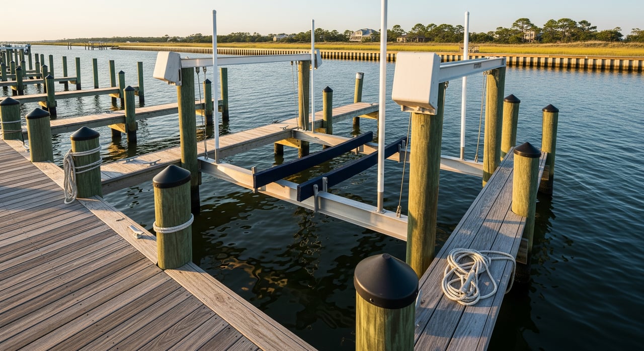
You will see two main dock approaches in the region. Fixed, pile-supported docks are common in shallow, stable bottoms where water levels do not swing dramatically. Floating docks rise and fall with the tides and can be better where seasonal water-level changes are more noticeable or the bottom is softer. Many homes add finger piers, T-heads or boat slips, and some owners include boat lifts to cut down on maintenance.
Materials range from pressure-treated timber to composite decking and aluminum framing. Salt, sun and marine borers shorten lifespans, so plan on routine inspections and maintenance every few years, plus periodic tightening of hardware and replacement of worn decking.
Siting is just as important as materials. Orientation should account for prevailing winds and fetch, the distance over open water that builds waves. You also need a clear, practical path to deeper water. Riparian considerations and setbacks apply in North Carolina. You often have the right to reasonable access to navigable waters, but exact boundaries and rights depend on your deed, lot type and any recorded easements. A current, stamped survey that shows the shoreline and mean water lines is essential.
Permitting snapshot in Dare County
Most waterfront structures require approvals. In North Carolina’s coastal counties, CAMA permits are administered by the N.C. Division of Coastal Management. Smaller, routine residential projects may qualify for general permits. Larger or more complex work, or anything in sensitive areas, often requires a major permit and longer review. If your work is in navigable waters or affects wetlands, U.S. Army Corps of Engineers authorizations can apply. Dare County zoning rules and any HOA standards add local requirements such as width limits, lighting and accessory rules. Timelines can range from weeks for simple approvals to many months for complex projects. A licensed marine contractor or coastal permitting specialist familiar with Dare County can help you choose the right path.
Draft and navigation: match boat to water
Draft is the vertical distance between your boat’s waterline and the bottom of the hull. You want depth at the dock and along your route to the nearest maintained channel at mean low water, plus a safety margin. Because water levels in the sounds change with wind and tides, plan around realistic low-water conditions, not just a nice day at mid-tide.
Depths are not static. Inlet dynamics around Oregon Inlet influence shoaling patterns, and storms can move sediment quickly. Private canals and narrow access routes may need periodic dredging. Before you write an offer, measure or obtain depth soundings at mean low water from the property to the closest maintained channel. Confirm whether any canal is actively maintained and by whom, and ask nearby marinas or boatyards about seasonal shoaling.
Here is a quick navigation checklist to use while touring:
- Identify the nearest marked or maintained channel and its typical depth.
- Take or commission depth soundings at mean low water along your planned route.
- Compare those depths to your boat’s draft plus a safety margin.
- Identify pinch points such as bends, canal mouths or areas with visible bars.
- Ask about dredging frequency, permit history and cost-sharing for any shared canal.
Access options and services
You can approach boating in Wanchese in a few ways, and the right choice depends on your vessel, your routine and your risk tolerance.
- Private dock. Direct access and convenience, with all maintenance, permitting and insurance decisions on you. This is attractive if you want to step from patio to boat, but you need to verify draft and long-term resilience.
- Community marina or canal. Shared maintenance and rules, plus potential dues and slip limits. This can be a good fit if you prefer predictable maintenance and do not need a private dock.
- Public ramps and nearby marinas. A strong alternative for larger vessels or if your lot’s approach is shallow or unreliable. You can still own waterfront for views and enjoyment while using a nearby facility for regular boating.
Also consider the local service ecosystem your boat will need. Boatyards, marine contractors, haul-out facilities, fuel docks and storage options all matter if you plan regular use, upgrades or seasonal care.
Risk, insurance and resilience
The Outer Banks region is hurricane prone. Docks, lifts and shorelines face storm surge, wave action and floating debris. Building with resilience in mind helps. Breakaway elements, robust piling and elevated connections can reduce damage in many scenarios, though no structure is risk free.
Insurance deserves early attention. Confirm your FEMA flood zone, and get quotes for flood coverage as well as wind or hurricane policies. Ask specifically how docks, boat lifts and other over-water structures are treated, because many policies limit or exclude these items. If dredging may be part of your long-term access, understand the permitting requirements and likely costs and who is responsible for them.
Shoreline stabilization choices are changing. Living shorelines that use marsh plantings and sills are commonly encouraged in suitable locations and can reduce erosion while supporting habitat. Bulkheads and riprap may still be permitted in some settings, but they can alter sediment transport. Sea-level rise should factor into siting and elevation decisions for any new or expanded dock.
Buyer due diligence checklist
Use this list to keep your purchase on track and avoid surprises:
- Get a current, stamped land survey that shows shoreline mean water lines and any easements.
- Request prior permits for existing docks, lifts or bulkheads, and confirm whether any structures are non-conforming.
- Confirm maintenance responsibilities for any canal, dock or private road with county records or association documents.
- Obtain recent depth soundings from your lot to the nearest maintained channel at mean low water.
- Ask the seller for a history of storm repairs, dredging or dock work, including dates, permits and costs.
- Review FEMA flood zone information and any elevation certificates, then secure preliminary quotes for flood and wind coverage.
- Visit the property at low tide and during typical wind conditions to observe wakes and fetch.
- If you plan to rebuild or expand, consult a licensed marine contractor and a coastal permitting specialist before finalizing your offer.
Who to call for specifics
When you are ready to verify site details, these agencies and professionals are your go-to resources:
- N.C. Division of Coastal Management for CAMA permitting guidance.
- U.S. Army Corps of Engineers, Wilmington District for federal Section 10 and Section 404 questions.
- Dare County Planning and Inspections for local zoning, building, septic and flood questions.
- NOAA nautical charts and local tide and current stations for navigation and water-level context.
- N.C. Division of Marine Fisheries and N.C. Wildlife Resources Commission for shellfish and habitat considerations.
- Local marinas, boatyards and licensed marine contractors for on-the-ground depth and construction experience.
- Licensed surveyors for shoreline delineation and boundary confirmation.
- Coastal permitting consultants or environmental attorneys for complex or contested sites.
How we help you buy with confidence
Buying waterfront in Wanchese blends lifestyle with logistics. You want a property that fits your boating plans, your risk profile and your budget for long-term care. As a boutique, owner-led team based at Pirate’s Cove Realty, we pair local waterfront knowledge with clear, responsive buyer representation. We help you target the right micro-markets, structure offers that reflect true access and maintenance realities, and negotiate with confidence.
If you are weighing private dock access versus a community marina, or deciding between canal-front and sound-front, we will guide your search and walk you through practical tradeoffs. When you are ready to tour, we focus your time on properties that align with draft, exposure and permitting considerations so you can move forward decisively.
Ready to explore Wanchese waterfront with a team that knows the waters and the market? Connect with Elizabeth Cloninger to get started.
FAQs
Can I build a new dock on a Wanchese lot?
- Possibly. Most projects require CAMA authorization and may involve federal and local approvals, with feasibility driven by your site, nearby resources and design.
How deep does the water need to be for my boat?
- You need your vessel’s draft plus a safety margin at mean low water along the route from your dock to a maintained channel, verified by recent local soundings.
Who pays for canal dredging or maintenance near my property?
- It varies. Responsibilities can fall to individual owners, an HOA or a public entity. Check covenants and county records to confirm cost sharing and schedules.
Are private docks covered by my homeowners policy?
- Not always. Docks, lifts and boats often require specific endorsements or separate coverage. Review policy details and get quotes early in the process.
Will commercial fishing activity near Wanchese affect my use?
- Yes. Expect working-vessel traffic, gear and wakes near working docks, which influences navigation, safety and sometimes permitted uses.